Python
I've written various scripts in Python, of which some are listed below. Click on the icon in front of the project to go to the GitHub page of the project.

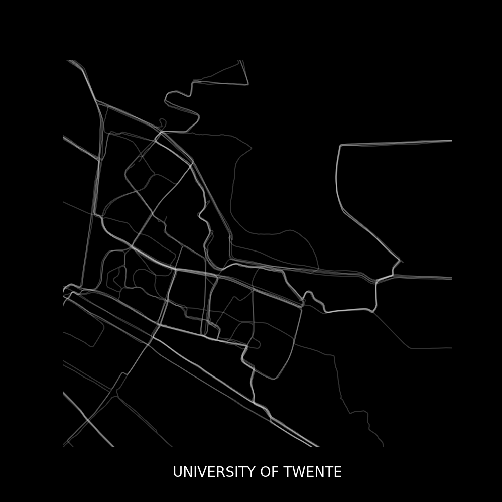
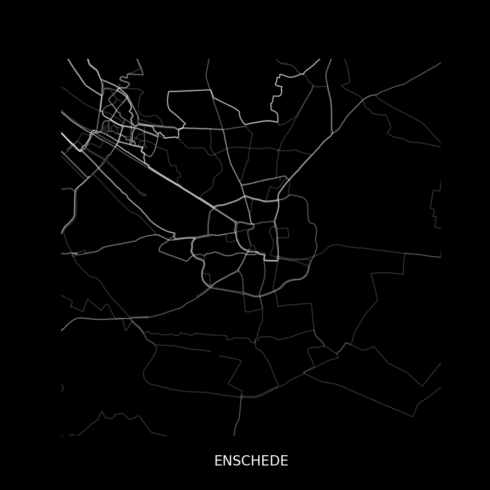
GPXheatgenThis script plots all .gpx files (sports activity GPS data collected by either Garmin devices / Strava / ...) that are within the same folder as the script. The script creates a heatmap such as the one shown below*
|
|
*These figures have been acquired by using the GPXheatgen code, but have been modified afterwards. The x- and y-limits have been changed to zoom in on specific parts of the map, and a title was added.
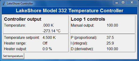
GUI applications for research equipment This Python repository contains a few GUI applications that allows one to communicate with various DAQ devices (via PyVISA) such as LakeShore temperature controllers, Oxford Magnet controllers, etc. The scripts have mainly been developed for personal use during my PhD, but they can also serve as a guide for those finding themselves in the position of creating their own applications. Below is a screenshot of a GUI for a LakeShore temperature controller.
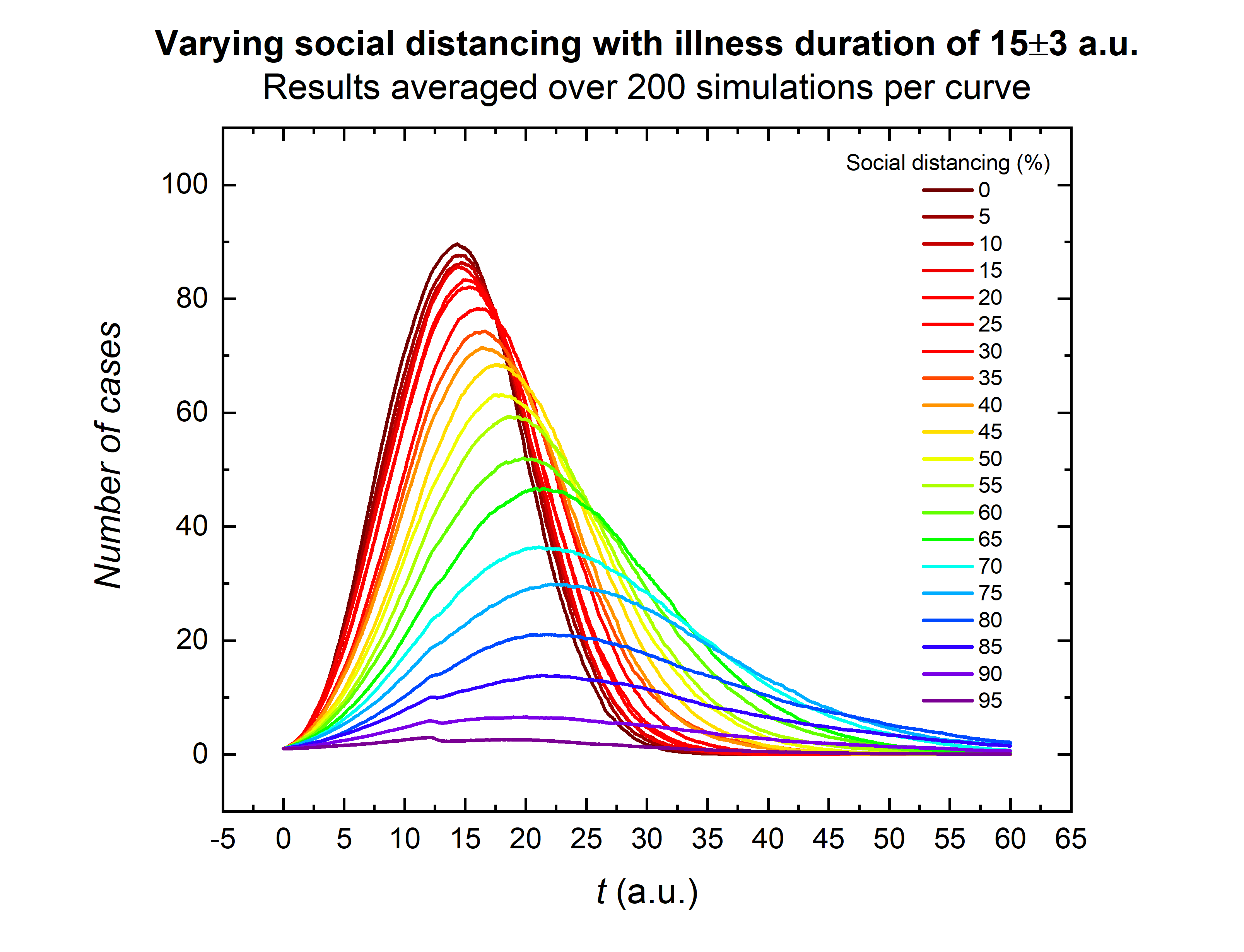
COVID-19 SIR simulation This repository contains a Python simulation for the spread of the COVID-19 (corona) virus. The repository is pretty much self-explanatory and includes an article that I wrote on both the technical details as well as on the physics behind it. The paper contains more results as well. Below, I only show the typical "flatten the curve" figure that is a direct result of the simulations.